


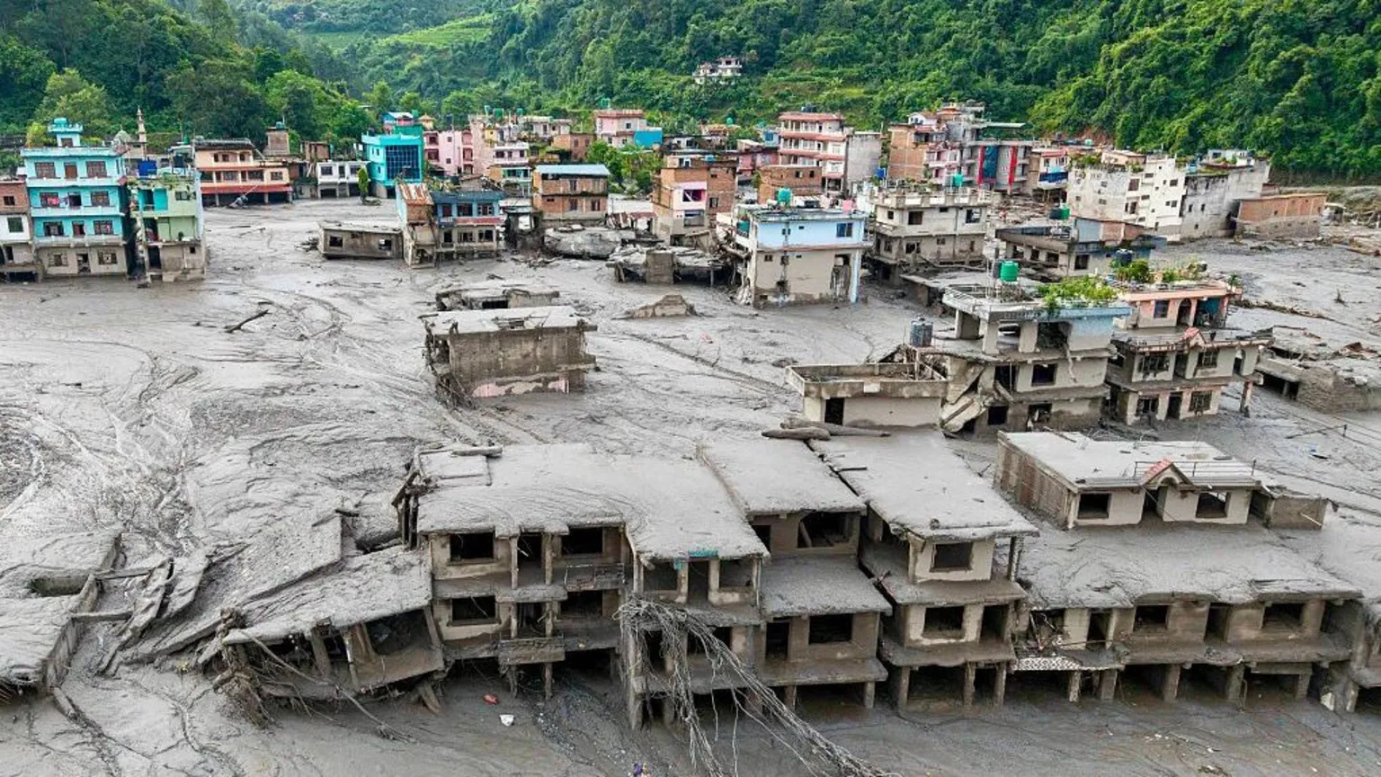
Nepal’s devastating floods are highlighting India’s exposure to transboundary rivers, extreme rainfall and fast-moving debris flows as climate change increases risks across the Himalayas.
Nepal’s deadly floods are raising concerns in India, where shared Himalayan rivers, extreme rainfall, fragile embankments and climate-driven hazards could worsen future disasters.
By MediaBites International Desk
NEW DELHI — Devastating floods in Nepal have exposed a growing risk for India, where rivers flowing south from the Himalayas can quickly turn extreme rainfall and mountain hazards into major disasters across the plains.
The warning comes as Nepal’s death toll from floods along its border with Tibet has crossed 1,000, according to the source material, highlighting the scale of increasingly dangerous events in the Himalayan region.
India and Nepal share a vast network of rivers, with more than 6,000 rivers and streams in Nepal, most draining south toward India and the Ganges. The major transboundary systems include the Kosi, Gandaki, Karnali and Mahakali, while smaller rivers such as the Bagmati, Kamala, Rapti and Babai can produce rapid and unpredictable flooding.
Bihar is the Indian state most exposed to flooding, with about three-quarters of north Bihar classified as flood-prone. Many of its major rivers originate in Nepal, including the Kosi, Gandak, Bagmati and Kamala.
The danger also extends into eastern Uttar Pradesh, where the Ghaghara, Rapti and Gandak regularly affect districts including Gorakhpur, Bahraich, Lakhimpur Kheri and Shravasti. Uttarakhand and parts of northern West Bengal also face risks from rivers originating or flowing through the Himalayan region.
But experts caution against viewing flooding in India simply as water flowing downstream from Nepal. The severity of a disaster depends on rainfall in both countries, river levels, embankments, barrages, drainage systems and development on floodplains.
“For the peak flow arriving at the border, largely Nepal’s rainfall; for the severity of flooding once it arrives, at least as much on Indian conditions,” said Saswata Sanyal of the International Centre for Integrated Mountain Development.
The 2008 Kosi disaster illustrates the danger. Nearly 400 people died after the river breached an embankment in Nepal and flooded parts of Bihar, even though the river was carrying only about a tenth of its carrying capacity, according to Rajiv Sinha, a professor at IIT Kanpur. The disaster was attributed to an embankment failure after years of inadequate maintenance.
India can receive between roughly 12 hours and two days of warning for conventional monsoon floods, depending on the river. Flash floods from smaller catchments can arrive within hours, while a debris flow or landslide-dam burst can move even faster. During the latest Nepal floods, a peak surge from Rasuwa reached near the Indian border in about seven and a half hours.
India and Nepal already share real-time rainfall and river-level information, but experts say gaps remain in monitoring fast-flowing catchments, forecasting systems and information about embankments, sediment and river-channel changes.
Scientists also warn that the region’s hazards are becoming more complex. Extreme rainfall is intensifying, while warming temperatures, degrading permafrost, glacial lake outbursts, rock-ice avalanches and heavier sediment loads could make floods faster and harder to predict.
The central concern for India, experts say, is therefore not simply how much water crosses the border from Nepal, but how the two countries manage an increasingly volatile Himalayan river system.
Better shared data, early-warning systems and coordinated river management could help reduce the risks for communities on both sides of the border.


11 Comments
If you are looking for international broadcasts across distinct regions, free global live tv directory provides a convenient listing. It organizes public media links into accessible categories for quick reference and continuous playback.
thanks for your share about teh cars , i really enjoy it , for those people who blind about cars
I switched from another site and the difference is huge. Promotions here actually have reasonable terms and the VIP rewards keep getting better with every level up. The app is stable and I never had to deal with annoying pop ups. A clean and professional setup that I can fully trust. korwin10
Found this site through a friend and I am glad I did. The bonuses are actually fair and the customer support is helpful. Give krvip17kr a try!
Everything is so professional here. I feel secure with my transactions and the variety of options is just great. neu88online is the real deal.
Using a free visual age test allows you to explore how digital algorithms evaluate skin texture, contour firmness, and structural maturity indicators.
Comparing top-ranking pages against your own requires structured extraction of keyword distributions. View competitor SEO analysis prompt blueprints for blueprints covering competitive SEO research.
Working inside an all-in-one workspace like the Seed Audio 1 voice generator studio enables media producers to fine-tune vocal generation settings for polished audio exports.
When preparing promotional graphics for diverse audiences, creators can substitute picture copy with AI tools. This web workspace is intended to assist with swapping localized text strings across exported marketing visuals.
Just joined and I am already impressed by how fair the promotions are. You actually get what they promise and the slot selection is massive. I love playing in the evenings after work and the site loads super fast on my tablet. A solid choice for casual and serious players alike. kirikiyacasino
Pasting web assistant output directly into desktop apps often leads to mismatched fonts and margins. Knowing how to clean up chatgpt text output saves time during document preparation.