


 Pakistan Rupee Exchange Rate
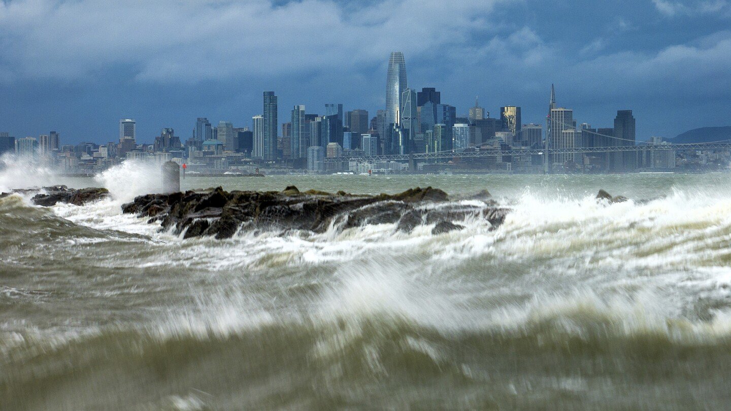
LOS ANGELES (news agencies) — The second of back-to-back atmospheric rivers drenched Northern California on Sunday, flooding roads, knocking out power to tens of thousands and leading forecasters to warn of possible hurricane-force winds and mudslides as it slowly heads south over the coming days.
The storm knocked down trees and power lines in the San Francisco Bay Area, where winds topped 60 mph (96 kph) in some areas. Gusts exceeding 80 mph (128 kph) were recorded in the mountains.
More than 200,000 customers were without electricity statewide, with most of the outages in the northern part of the state, according to poweroutage.us.
“We’re not out of the woods yet — strong winds will continue through the early evening today,” the Bay Area’s National Weather Service said.
Six Bay Area counties were at low risk of waterspouts coming ashore and becoming tornadoes, said the Storm Prediction Center. The last time the center forecasted a tornado risk in the region was in February 2015, according to the San Francisco Chronicle.
Palisades Tahoe, a ski resort about 200 miles (320 kilometers) northeast of San Francisco, said it was anticipating the heaviest snowfall yet this season, with accumulations of 6 inches (15 centimeters) per hour for a total of up to two feet (60 centimeters). Heavy snow was possible into Monday throughout the Sierra Nevada.
Meanwhile, Southern California was at risk of substantial flooding beginning late Sunday because of how slow the system was moving, said Ryan Kittell, a meteorologist at the weather service’s Los Angeles-area office.
“The core of the low pressure system is very deep, and it’s moving very slowly and it’s very close to us. And that’s why we have those very strong winds. And the slow nature of it is really giving us the highest rainfall totals and the flooding risk,” he said at a Sunday briefing.


