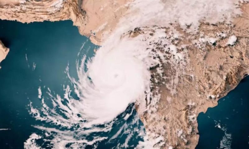
The east-central Arabian Sea is currently experiencing the presence of an extremely severe cyclonic storm named “Biparjoy.” Over the past 12 hours, the storm has moved northward and is now located near Latitude 19.5°N and Longitude 67.7°E. It is approximately 600 kilometers south of Karachi, 580 kilometers south of Thatta, and 710 kilometers southeast of Ormara.
The cyclonic storm exhibits maximum sustained surface winds ranging from 160 to 180 kilometers per hour, with gusts reaching 200 kilometers per hour near its center. Sea conditions around the storm center are extremely intense, with maximum wave heights measuring 35 to 40 feet.The system benefits from favorable environmental conditions, including a sea surface temperature of 30-31°C, low vertical wind shear, and upper-level divergence. These factors contribute to the system’s sustained intensity.
Based on the current upper-level steering winds, it is expected that the ESCS “Biparjoy” will continue its northward track until the morning of June 14. Subsequently, it will recurve northeastward and make landfall between Keti Bandar (Southeast Sindh) and the coast of Indian Gujarat on the afternoon of June 15 as a very severe cyclonic storm (VSCS).The cyclone warning center in Karachi, operated by the Pakistan Meteorological Department (PMD), is closely monitoring the system and will provide updates accordingly.
Potential impacts of the cyclonic storm include widespread wind-dust/thunderstorm rain with heavy to extremely heavy falls and squally winds of 80-100 kilometers per hour gusting up to 120 kilometers per hour in Thatta, Sujawal, Badin, Tharparker, Mirpurkhas, and Umerkot districts from June 13 to 17.
In Karachi, Hyderabad, Tando Muhammad Khan, Tando Allayar, Nawabshah, and Sanghar districts, there is a likelihood of dust/thunderstorm-rain with a few heavy falls and squally winds of 60-80 kilometers per hour between June 14 and 16.
The high-intensity squally winds may cause damage to vulnerable structures such as kutcha houses and solar panels.A storm surge of 3-3.5 meters (8-12 feet) is expected at the landfall point (Keti Bandar and surrounding areas), posing a risk of inundation to low-lying settlements.
Fishermen are strongly advised to refrain from venturing into the open sea until the system dissipates by June 17, as the Arabian Sea conditions may become very rough/high with high tides along the coast.


